

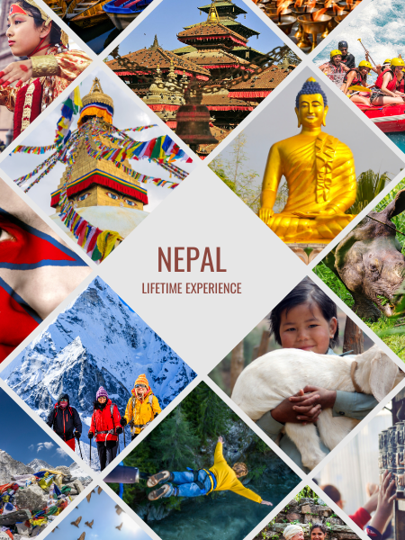
Nepal
“Lifetime Experience”

Nepal Travel Destination Overview
Nepal, a country nestled in the Himalayas of South Asia, is a traveler's paradise. Known for its breathtaking natural beauty, rich cultural heritage, and warm hospitality, Nepal is a must-visit destination for anyone interested in exploring the great outdoors. From the snow-capped mountains to the lush valleys, Nepal offers a diverse range of landscapes and experiences that cater to all types of travelers.
Geography and Climate
Nepal is home to eight of the world's ten highest mountains, including the mighty Mount Everest, the highest peak in the world. The country's geography is characterized by rugged terrain, snow-capped mountains, and dense forests. The climate varies from tropical in the south to temperate and alpine in the north. The monsoon season, which runs from June to September, brings heavy rainfall and high humidity, while the winter months from December to February are cold and dry.
Cultural Heritage
Nepal is a culturally rich and diverse country, with a history dating back over 2,000 years. The country has a long tradition of Buddhism and Hinduism, and is home to many sacred temples and shrines. The capital city, Kathmandu, is a UNESCO World Heritage Site and is known for its vibrant culture, colorful festivals, and ornate architecture.
Adventure Activities
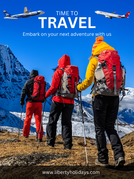
Nepal is an adrenaline junkie's dream come true. From trekking and climbing to rafting and paragliding, there are numerous adventure activities that can be enjoyed in the country. The Himalayas offer some of the most challenging and rewarding trekking routes in the world, while the rivers offer opportunities for rafting and kayaking.
Trekking Routes
Nepal has some of the most popular trekking routes in the world, including:
• Everest Base Camp Trek: A classic trek that takes you to the foot of Mount Everest
• Annapurna Circuit Trek: A challenging trek that takes you through some of the most remote regions of Nepal
• Langtang Valley Trek: A shorter trek that offers stunning views of the Langtang Valley
• Manaslu Circuit Trek: A challenging trek that takes you through some of the most remote regions of Nepal
Cities
Nepal has several cities that are worth visiting, including:
• Kathmandu: The capital city of Nepal and a UNESCO World Heritage Site
• Pokhara: A lakeside town that offers stunning views of the Himalayas
• Patan: An ancient city that is known for its temples and palaces
• Bhaktapur: An ancient city that is known for its pottery and crafts
Food and Drink
Nepalese cuisine is a fusion of Indian and Tibetan flavors, with popular dishes such as dal bhat (lentil soup with rice), momos (Tibetan dumplings), and sel roti (sweet rice). The country is also famous for its tea, which is grown in the hills of northern Nepal.
Best Time to Visit
The best time to visit Nepal depends on your personal preferences and the activities you have planned. However, most tourists visit Nepal during the spring (March to May) and autumn (September to November) seasons.
Here's a breakdown of the seasons in Nepal:
Spring (March to May)
• Weather: Mild temperatures, clear skies, and blooming flowers
• Activities: Trekking, hiking, and sightseeing
• Pros: Comfortable weather, fewer crowds, and scenic landscapes
• Cons: Some trekking routes may be closed due to snowmelt
Autumn (September to November)
• Weather: Clear skies, mild temperatures, and minimal rainfall
• Activities: Trekking, hiking, and sightseeing
• Pros: Comfortable weather, clear views, and fewer crowds
• Cons: Some trekking routes may be crowded
Summer (June to August)
• Weather: Hot and humid temperatures, frequent rainfall, and occasional thunderstorms
• Activities: Wildlife safaris, rafting, and water sports
• Pros: Green landscapes, baby animals being born, and fewer crowds
• Cons: Uncomfortable weather, frequent rain showers, and possible closures of trekking routes
Winter (December to February)
• Weather: Cold temperatures, foggy mornings, and occasional snowfall
• Activities: Trekking at lower altitudes, cultural festivals, and yoga retreats
• Pros: Low season prices, fewer crowds, and scenic landscapes
• Cons: Cold temperatures, possible road closures, and limited accessibility
Best time for specific activities
• Trekking: Spring (March to May) and autumn (September to November)
• Hiking: Spring (March to May) and autumn (September to November)
• Wildlife safaris: Summer (June to August)
• Rafting and water sports: Summer (June to August)
• Yoga retreats: Winter (December to February)
• Cultural festivals: Winter (December to February)
Keep in mind that these are general guidelines, and the best time to visit Nepal ultimately depends on your personal preferences and the specific activities you have planned.
Safety Tips
Nepal is generally a safe country to visit, but there are some precautions that you should take:
• Be mindful of your belongings in crowded areas
• Avoid traveling at night or alone
• Wear appropriate clothing when visiting temples or shrines
• Bring a good quality camera to capture the stunning views
Conclusion
Nepal is a country that offers something for everyone. From its stunning natural beauty to its rich cultural heritage, there are countless reasons to visit this incredible country. With its warm hospitality, delicious cuisine, and adventure activities, Nepal is an unforgettable destination that will leave you with lifelong memories.
Things To Do in Nepal
Nepal is a paradise for adventure seekers and nature lovers. With its breathtaking landscapes, rich cultural heritage, and warm hospitality, there are countless things to do and experience in this incredible country. Here are some of the top things to do in Nepal:
Explore the Himalayas
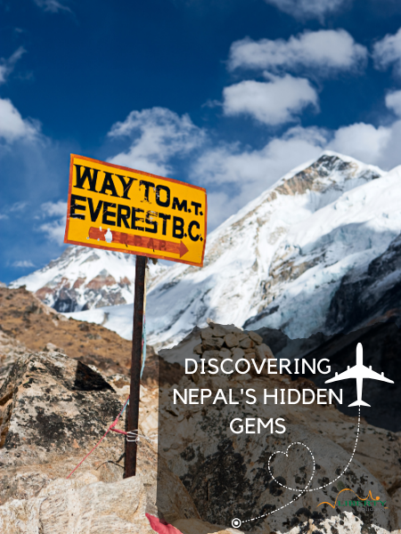
- Trek to Everest Base Camp: One of the most iconic treks in the world, take a journey to the foot of Mount Everest.
- Go hiking: Explore the scenic trails of the Himalayas and enjoy stunning views of the surrounding mountains.
- Go climbing: For experienced climbers, Nepal offers some of the most challenging and rewarding climbs in the world.
Discover the Culture
• Visit ancient temples and palaces: Learn about Nepal's rich cultural heritage by visiting ancient temples and palaces.
• Attend a festival: Nepal has a vibrant festival calendar, with many colorful festivals throughout the year.
• Take a cooking class: Learn how to cook traditional Nepalese dishes like dal bhat and momos.
Get Active
• Go rafting: Experience the thrill of white water rafting on one of Nepal's many rivers.
• Go paragliding: Take in the stunning views of the Himalayas from above.
• Go birdwatching: Nepal is home to over 800 species of birds, making it a paradise for birdwatchers.
Other Activities
• Visit the national parks: Nepal has several national parks, including Chitwan National Park and Langtang National Park.
• Take a yoga class: Relax and rejuvenate with a yoga class in one of Nepal's many yoga studios.
• Go on a wildlife safari: Take a guided tour to spot some of Nepal's unique wildlife, including rhinos and tigers.
Tours
Want to experience all these activities and more? Check out our range of tours in Nepal:
• Journey to the earth's highest mountain: Everest 15 Days
• 6 Day Buddhist Pilgrimage with Kathmandu Sightseeing Tour
• Best of Kathmandu Valley 5 Days Trip
These tours offer a unique and unforgettable experience in Nepal. From trekking to cultural tours, there's something for everyone. Book now and get ready for an adventure of a lifetime!
Fast Facts about Nepal
• Location: South Asia, bordered by India and Tibet
• Capital City: Kathmandu
• Population: Approximately 31 million people
• Language: Nepali (official language), English widely spoken
• Currency: Nepalese Rupee (NRs)
• Religion: Hinduism, Buddhism, Islam, Christianity
• Government: Federal parliamentary republic
• Time Zone: UTC+5:45 (GMT+5:45)
• National Animal: Himalayan Tahrs
• National Bird: Impeyan Pheasant
• National Flower: Rhododendron
• National Tree: Rhododendron
• Highest Point: Mount Everest (8,848 meters/29,029 ft)
• Longest River: Kosi River (720 km/450 miles)
• Tallest Mountain: Mount Everest (8,848 meters/29,029 ft)
• Longest Mountain Range: Himalayas (2,500 km/1,553 miles)
Useful Information
• Visa Requirements: Visa on arrival for most nationalities
• Vaccinations: Recommended vaccinations include hepatitis A, typhoid, and rabies
• Weather: Monsoon season from June to September, winter from December to February
• Currency Exchange: Available at banks and currency exchange offices
• Tipping: 5-10% in restaurants and bars, 10-20% for guides and drivers
Travel Tips for Nepal
Before You Go
• Check the weather: Nepal has a varied climate, with monsoon season from June to September and winter from December to February. Pack accordingly.
• Get travel insurance: Make sure you have adequate coverage for medical and travel emergencies.
• Research visas: Check the requirements for your nationality and apply in advance if necessary.
• Pack light: Nepal is a developing country, and transportation infrastructure may not always be reliable. Pack lightly and be prepared for unexpected delays.
On the Ground
• Respect local culture: Nepal is a conservative country, and dress modestly when visiting temples and palaces.
• Stay hydrated: Nepal's high altitude can be challenging, especially in the mountains. Drink plenty of water and avoid dehydration.
• Use reputable transportation: Avoid using unlicensed taxis or buses, and opt for reputable companies instead.
• Haggle politely: In Nepal's markets, it's customary to haggle over prices. Do so politely and respectfully.
Health and Safety
• Stay healthy: Make sure you have all necessary vaccinations before traveling, and take precautions against illnesses such as altitude sickness and diarrhea.
• Be aware of your surroundings: Pickpocketing and theft can occur in crowded areas. Keep valuables secure and be mindful of your belongings.
• Stay informed: Check local news and authorities' websites for updates on any travel advisories or health concerns.
Etiquette and Culture
• Remove your shoes: When entering temples, palaces, or homes, it's customary to remove your shoes.
• Use your right hand: When giving or receiving something, use your right hand to show respect.
• Learn some Nepali phrases: Show respect for the local culture by learning basic phrases like "Namaste" (hello), "Dhanyabaad" (thank you), and "Chha" (excuse me).
Trekking and Adventure
• Bring necessary gear: When trekking, bring essential gear such as comfortable shoes, layers of clothing, and a backpack.
• Acclimatize slowly: When ascending to high altitudes, do so gradually to avoid altitude sickness.
• Respect local environment: Be mindful of Nepal's fragile environment and take all trash with you when trekking or camping.
Additional Tips
• Exchange money wisely: Exchange currency at reputable banks or currency exchange offices to avoid losing money.
• Make copies of important documents: Make digital copies of important documents such as passports, visas, and travel insurance policies.
• Stay connected: Mobile networks are widely available in Nepal, but consider purchasing a local SIM card for better coverage.