

Bhutan
“Happiness is a place”

Discover the Hidden Kingdom of Bhutan
Nestled in the Himalayas, Bhutan is a mystical and enchanting country that offers a unique and unforgettable travel experience. This tiny kingdom is known for its pristine natural beauty, rich culture, and strong commitment to sustainable tourism. With its stunning mountains, lush valleys, and vibrant festivals, Bhutan is a destination that will leave you in awe.
Bhutan Travel Highlights
• Immerse in Buddhist Culture: Explore ancient temples, monasteries, and dzongs (fortresses) that showcase the country's rich cultural heritage.
• Experience the Great Outdoors: Hike to the highest points in the Himalayas, trek through lush forests, and take in breathtaking views of the surrounding mountains.
• Visit Vibrant Festivals: Join the locals in celebrating colorful festivals like the Paro Festival and the Thimphu Tsechu, which feature traditional music, dance, and costumes.
• Indulge in Local Cuisine: Savor traditional Bhutanese dishes like emadatse (spicy chili pepper), kewa (potato) and datse (cheese), and enjoy a cup of butter tea at a local farmhouse.
• Take Part in Sustainable Tourism: Support eco-friendly initiatives and responsible tourism practices that promote the preservation of Bhutan's environment and culture.
Best Time to Visit Bhutan
Bhutan has a subtropical climate with four distinct seasons. The best time to visit depends on your preferences:
• Spring (March to May): Mild temperatures and blooming flowers make it an ideal time for trekking.
• Autumn (September to November): Comfortable temperatures and stunning views of the Himalayas make it perfect for outdoor activities.
• Winter (December to February): Experience the festive atmosphere and enjoy winter sports like skiing and snowshoeing.
• Summer (June to August): Warm temperatures and lush green landscapes make it ideal for cultural exploration.
Getting There
Bhutan is a remote country, but it's accessible by air. The only international airport is in Paro, which receives flights from major hubs like Delhi, Kathmandu, and Bangkok.
Why Choose Liberty Holidays for Bhutan Travel
At Liberty Holidays, we're committed to providing you with a unique and personalized travel experience. Our expert team will guide you through every step of your journey, from planning to execution. We'll help you create unforgettable memories in this enchanting country.
Contact us today to start planning your Bhutan adventure!
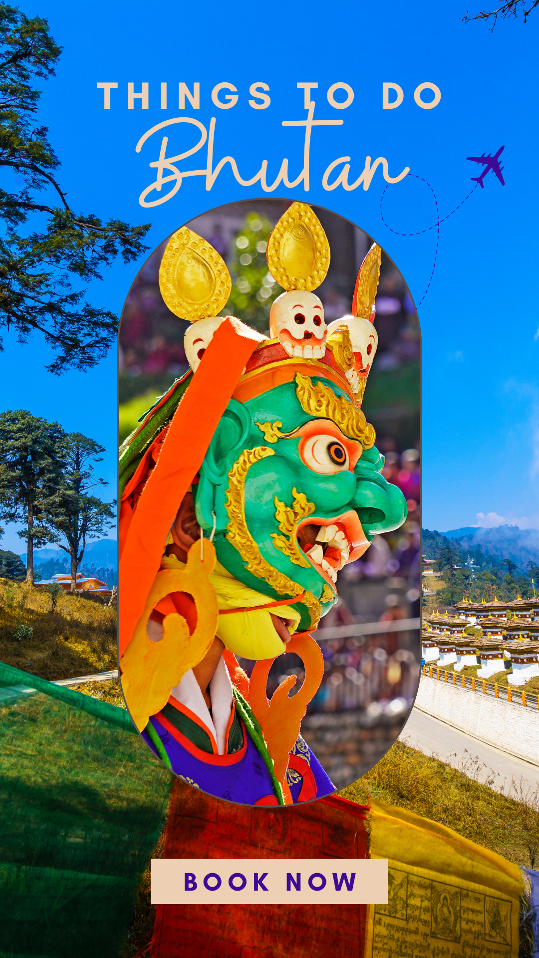
Things To Do in Bhutan
Bhutan is a paradise for adventure seekers, culture lovers, and nature enthusiasts. With its unique blend of tradition and modernity, there's always something to do or explore in this enchanting country. Here are some of the top things to do in Bhutan:
Explore Ancient Monasteries and Fortresses
Discover the rich history and culture of Bhutan by visiting ancient monasteries and fortresses like Paro Taktsang (Tiger's Nest), Punakha Dzong, and Wangdue Phodrang.
Trek to the Himalayas
Embark on a thrilling trekking adventure through the Himalayas, exploring lush valleys, picturesque villages, and breathtaking mountain vistas.
Experience Local Festivals and Events
Join the locals in celebrating vibrant festivals like the Paro Festival, Thimphu Tsechu, and Punakha Drubchen, which showcase traditional music, dance, and costumes.
Visit the National Museum
Learn about Bhutan's rich history and culture at the National Museum in Thimphu, which features a vast collection of artifacts, paintings, and relics.
Take a Hot Air Balloon Ride
Soar above the Himalayas on a hot air balloon ride, taking in breathtaking views of the mountains and valleys below.
Go on a Wildlife Safari
Explore the beautiful forests and valleys of Bhutan on a wildlife safari, spotting rare animals like the red panda, snow leopard, and Himalayan monal.
Try Local Cuisine
Indulge in delicious local cuisine, including traditional dishes like emadatse (spicy chili pepper), kewa (potato), and datse (cheese), as well as modern fusion cuisine.
Learn About Sustainable Tourism
Discover how Bhutan is leading the way in sustainable tourism, with initiatives like eco-friendly accommodations and responsible travel practices.
Tour Options
Explore our range of tour options in Bhutan:
• Discover Bhutan & Nepal: 11-Day Odyssey
• Discover the Kingdom of Happiness: 9-Day Bhutan & Nepal Journey
• Bhutan Bliss: 4-Day Quick Escape
• Discover Bhutan: 5-Day Getaway
Contact us today to start planning your unforgettable Bhutan adventure!
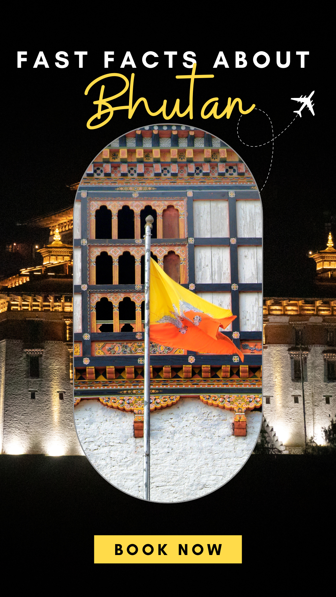
Fast Facts about Bhutan
• Location: Located in the Himalayas, bordering India and China
• Population: Approximately 771,000 people
• Language: Dzongkha (official language), Nepali, and English widely spoken
• Currency: Ngultrum (BTN)
• Time Zone: UTC+6 (GMT+6)
• Capital City: Thimphu
• Currency: Bhutan is one of the few countries in the world where the government measures the success of the country not by GDP but by GNH (Gross National Happiness)
• Visa: Tourism visa available on arrival, electronic visa available online
• Weather: Subtropical climate with four distinct seasons: spring (March to May), summer (June to August), autumn (September to November), and winter (December to February)
• Best Time to Visit: Spring (March to May) and autumn (September to November) are considered the best times to visit Bhutan due to mild weather and scenic landscapes
• Religion: Vajrayana Buddhism is the dominant religion
• Dress Code: Dress modestly and respectfully when visiting monasteries and temples
• Tipping: Tipping is not customary in Bhutan, but it's appreciated for good service
• Power Outages: Power outages are common in rural areas, so it's a good idea to pack a portable charger
Interesting Facts
• Carbon Neutral: Bhutan is one of the only carbon-neutral countries in the world
• Monastic System: Bhutan has a unique monastic system where monks and nuns are responsible for governing the country
• National Animal: The red panda is the national animal of Bhutan
• National Bird: The Himalayan monal is the national bird of Bhutan
• Gross National Happiness: Bhutan's unique philosophy of measuring success by Gross National Happiness (GNH) aims to balance economic development with spiritual well-being
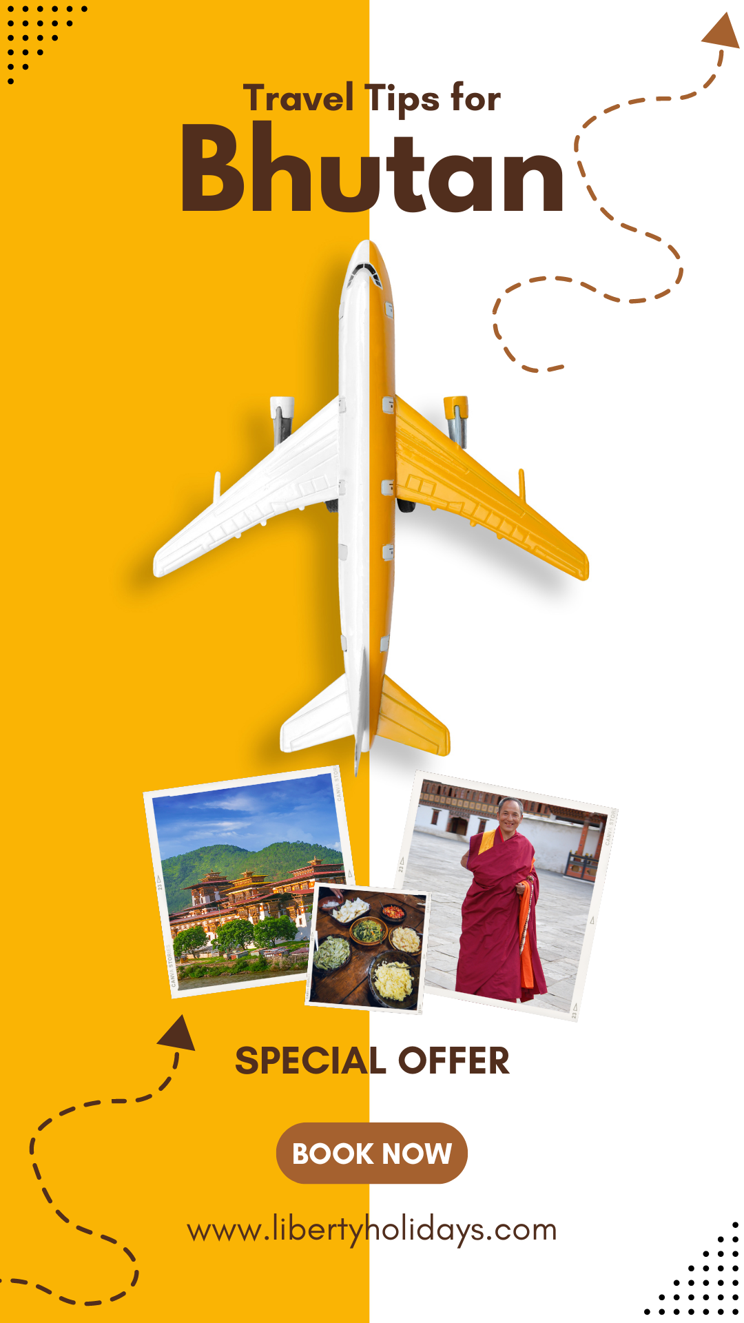
Travel Tips for Bhutan
Before You Go
• Visa: Obtain a visa in advance, Liberty Holidays will process the e-Bhutan visa on your behalf which normally takes a week. We will e-mail you a copy of the e-Bhutan visa once it is approved.
• Vaccinations: Consult your doctor or a travel clinic about necessary vaccinations and medications
• Insurance: Make sure you have comprehensive travel insurance that covers medical, evacuation, and trip cancellations
Packing Essentials
• Clothing: Pack layers for changing weather conditions, and comfortable walking shoes for trekking
• Insect Repellent: Bring insect repellent with DEET to protect against mosquitoes and leeches
• Sun Protection: Bring sunscreen, sunglasses, and a hat to protect against the sun
• Power Adapter: Bring a power adapter for charging electronic devices (Type C, Type D, and Type E)
• Camera: Bring a camera with a good battery life and memory storage, as well as a charger
On the Go
• Respect Local Culture: Dress modestly when visiting monasteries and temples, and remove your shoes before entering sacred spaces
• Buddhist Customs: Learn about Buddhist customs and traditions to avoid unintentionally offending locals
• Guided Tours: Consider hiring a guide or joining a guided tour to get the most out of your trip
• Tipping: While tipping is not customary in Bhutan, it's appreciated for good service
Health and Safety
• Altitude Sickness: Be prepared for altitude sickness, especially if you're traveling to high-altitude areas
• Water: Drink plenty of water and avoid drinking tap water
• Food: Try local cuisine, but avoid eating undercooked or raw food
• Emergency Contacts: Carry emergency contact numbers and a list of important phone numbers
Sustainable Tourism
• Responsible Travel: Follow responsible travel practices to minimize your impact on the environment
• Eco-Friendly Accommodations: Choose eco-friendly accommodations that support sustainable tourism practices
• Support Local Communities: Support local communities by buying local products and services
Technology
• Mobile Network: Mobile network coverage is limited in rural areas, so be prepared for occasional connectivity issues
• Internet: Internet access is limited in rural areas, but many hotels and restaurants offer Wi-Fi
Additional Tips
• Flexibility: Be prepared for changes in itinerary due to weather conditions or other unforeseen circumstances
• Patience: Travel slowly and enjoy the journey, as rush hour traffic is common in Thimphu
• Smiling: Smile widely and often, as it's a sign of respect and friendliness in Bhutanese culture